UAVOS Adds Real-Time Visualization to NAVAI Navigation for GNSS-Degraded Operations
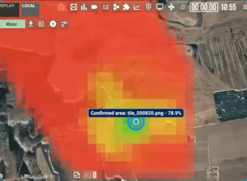
UAVOS has developed a visualization application for its NAVAI vision-based navigation system for use with the portable ground control station. When a communication link with the UAV is available, the system allows the operator to visualize how NAVAI and the autopilot work, including the logic used to select navigation data sources. In this way, the visualization app turns NAVAI’s algorithmic process into an operator-friendly monitoring tool: the user sees not only the resulting position estimate, but also a clear representation of how the system matches onboard images with terrain data.
The application lets the operator follow how NAVAI and the autopilot arrive at the UAV’s position estimate in real time: which reference imagery is being matched, the confidence level of the match, and when the system accepts or rejects a visual fix. Based on what they see, operators can adjust NAVAI parameters directly from the ground control station. For example, operators can adjust the match-confidence threshold or the weighting between visual and inertial sources and immediately observe the effect on the estimated track.
In the portable ground control station interface, the operator can observe:
- the estimated flight path of the unmanned aircraft over the orthophoto map;
- areas of the satellite map used by the system for image matching;
- the results of the visual positioning algorithms;
- the confirmed onboard position, when the matching quality and other conditions allow the system to determine the UAV’s coordinates with the required level of confidence.
NAVAI is a vision-based navigation module for unmanned aerial systems, designed to improve flight resilience during beyond-visual-line-of-sight operations under conditions of GNSS spoofing and jamming . NAVAI uses neural networks to match images captured by onboard cameras in real time with preloaded terrain maps, helping unmanned aerial vehicles determine their position when satellite navigation cannot be relied upon. Its operation can complement standard navigation sources and provide an additional layer of situational awareness regarding the UAV’s position.

“The NAVAI visualization application is driven by one goal: giving operators greater confidence, flexibility, and capability," said Aliaksei Stratsilatau, Founder and CEO of UAVOS. “The recent application is a great example of how we are constantly evolving our platforms to ensure they are at the forefront of technology while providing best-in-class capabilities to operators.”
06 October 2026